
International
ADVANCED AND APPLIED SCIENCES
EISSN: 2313-3724, Print ISSN: 2313-626X
Frequency: 12
![]()
Volume 9, Issue 11 (November 2022), Pages: 34-43

----------------------------------------------
Original Research Paper
Wildfires damage assessment Via LiDAR
Author(s): Vivian Sultan *, Taron Sarksyan, Savita Yadav
Affiliation(s):
College of Business and Economics, California State University, Los Angeles, USA

* Corresponding Author.
 Corresponding author's ORCID profile: https://orcid.org/0000-0002-1066-5212
Digital Object Identifier:
https://doi.org/10.21833/ijaas.2022.11.004
Abstract:
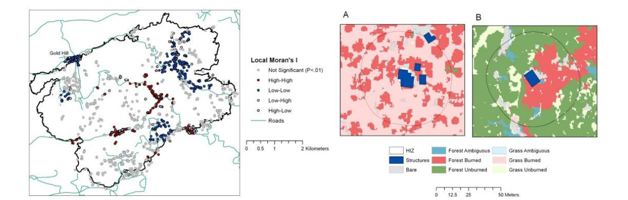
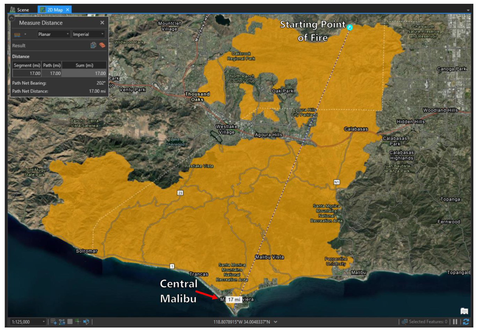
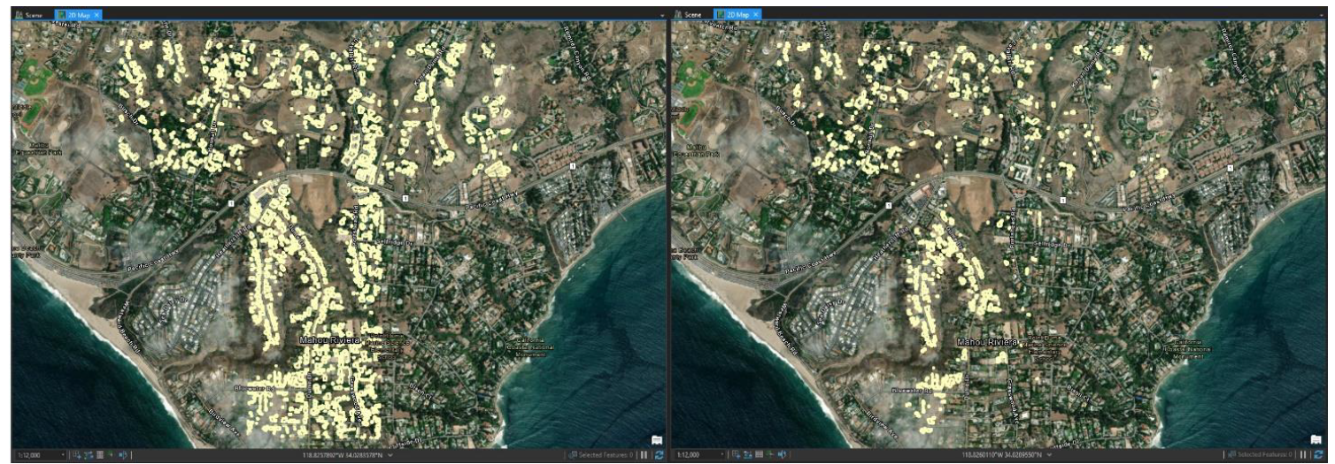
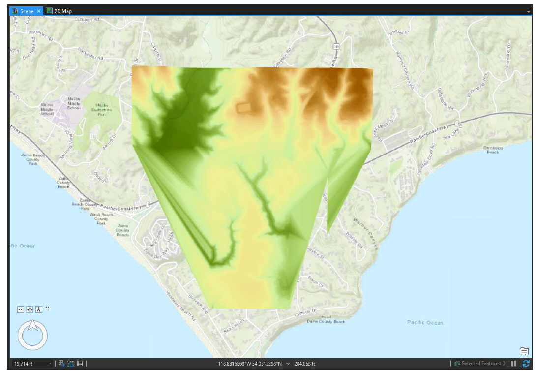
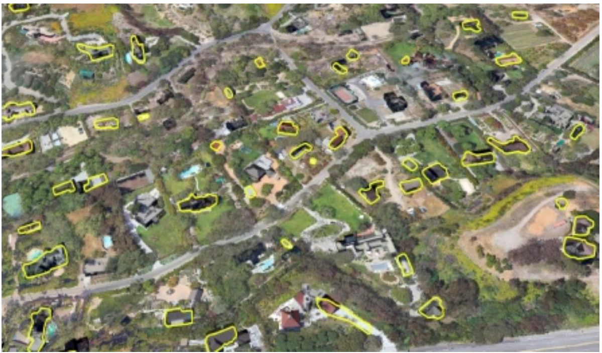
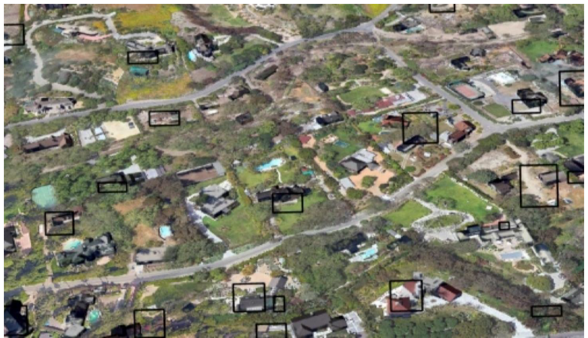
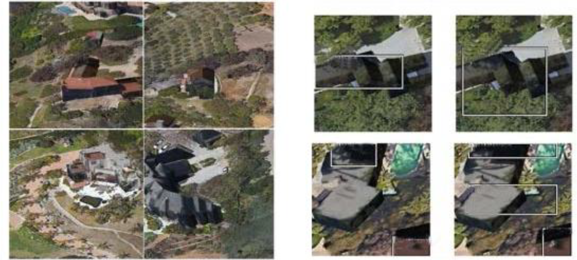
This paper examines the phenomenon of wildfires in California and investigates the buildings affected by the Woolsey Fire in Central Malibu in 2018. We focus empirically on machine learning to identify damaged objects from point-cloud data. This project includes a literature review with references to methods used for wildfire research and LiDAR data processing. In this study, researchers trained an existing deep learning model to determine if it offers an effective solution for extracting damaged objects. Data sources for this study include point-cloud data retrieved via the LidarExplorer tool and Kaggle’s 2013–2020 California wildfire data. Using two layers of building footprints in the Malibu “T-Zone” revealed 907 structures, of which 435 were damaged or destroyed based on map observations. This analysis of structure identification supports the literature that deep learning can successfully classify objects damaged by wildfires.
© 2022 The Authors. Published by IASE.
This is an
Keywords: LiDAR, ArcGIS, Damaged objects, Deep learning
Article History: Received 4 April 2022, Received in revised form 20 July 2022, Accepted 26 July 2022
Acknowledgment
This research is based on students’ course project work at the graduate school, Information Systems department of California State University, Los Angeles. The second and the third author would like to acknowledge Professor Vivian Sultan for her guidance and contribution to this research project. This research received no external funding.
Compliance with ethical standards
Conflict of interest: The author(s) declared no potential conflicts of interest with respect to the research, authorship, and/or publication of this article.
Citation:
Sultan V, Sarksyan T, and Yadav S (2022). Wildfires damage assessment Via LiDAR. International Journal of Advanced and Applied Sciences, 9(11): 34-43
Figures
Fig. 1 Fig. 2 Fig. 3 Fig. 4 Fig. 5 Fig. 6 Fig. 7 Fig. 8 Fig. 9 Fig. 10 Fig. 11 Fig. 12 Fig. 13
Tables
No Table
----------------------------------------------
References (8)
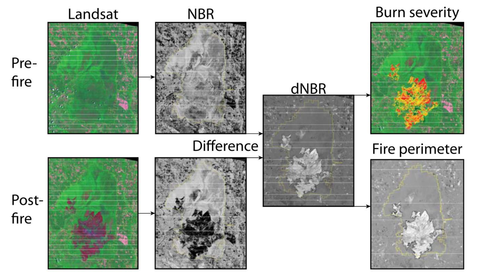
- Eidenshink J, Schwind B, Brewer K, Zhu ZL, Quayle B, and Howard S (2007). A project for monitoring trends in burn severity. Fire Ecology, 3(1): 3-21. https://doi.org/10.4996/fireecology.0301003 [Google Scholar]
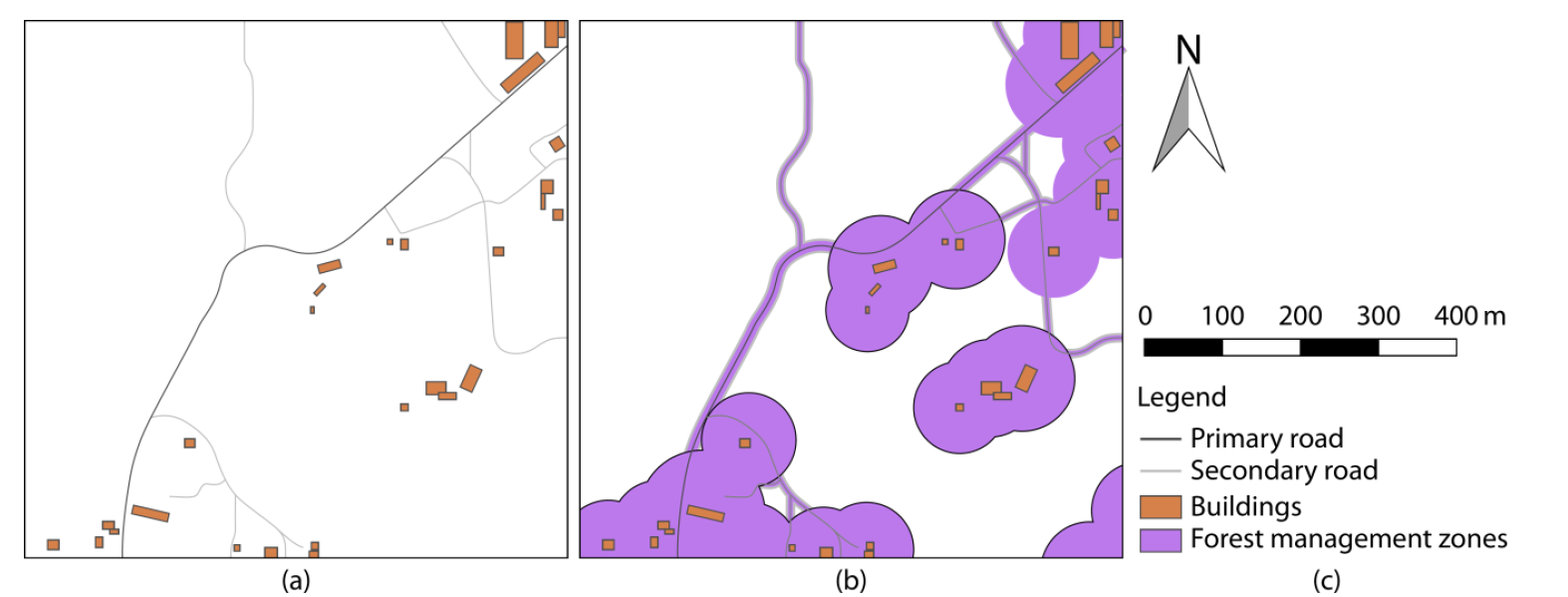
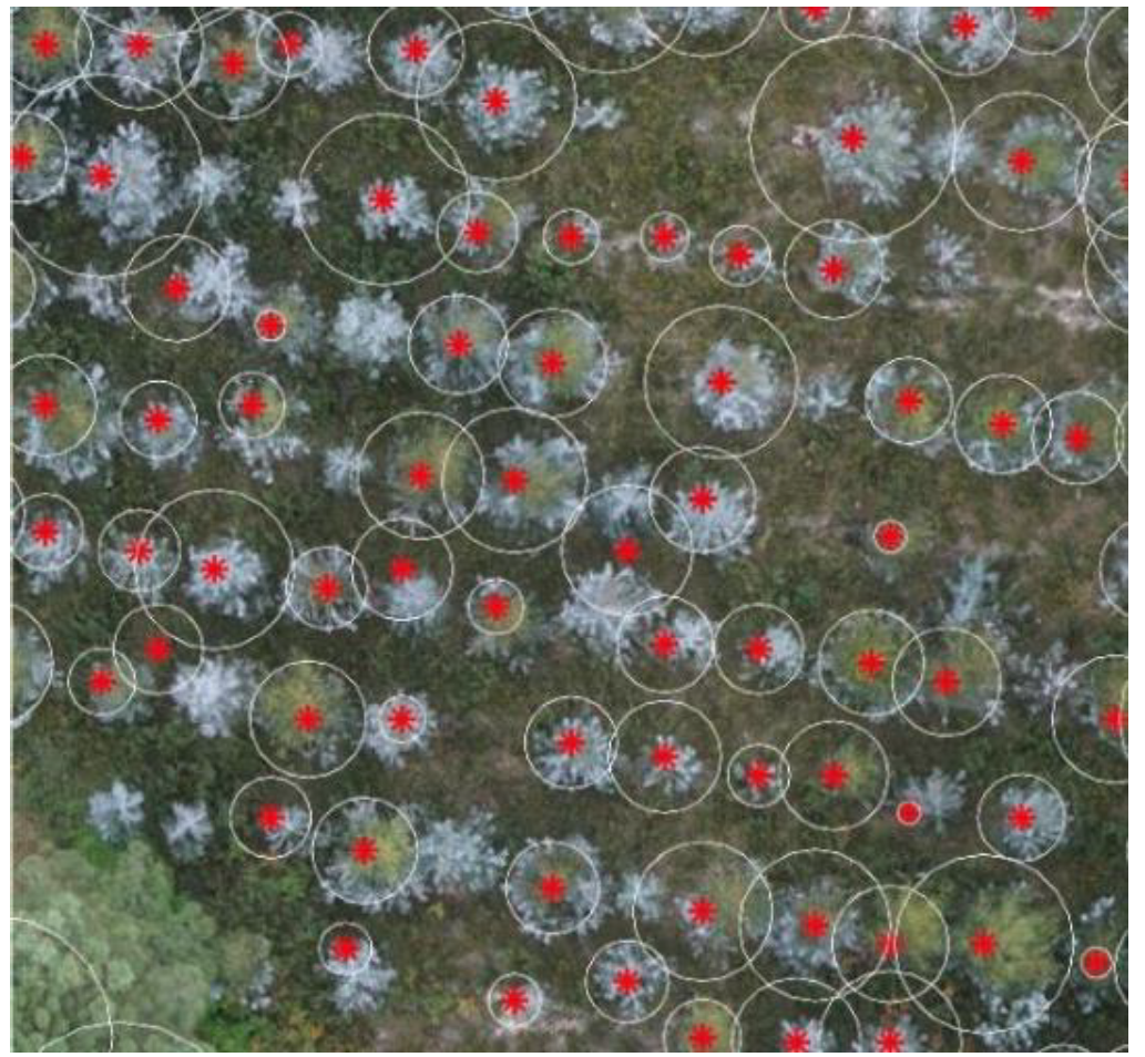
- Fernández-Álvarez M, Armesto J, and Picos J (2019). LiDAR-based wildfire prevention in WUI: The automatic detection, measurement and evaluation of forest fuels. Forests, 10(2): 148. https://doi.org/10.3390/f10020148 [Google Scholar]
- Kaggle (2021). California wildfire incidents (2013–2020): List of Wildfires in California between 2013 and 2020. Available online at: https://www.kaggle.com/ananthu017/california-wildfire-incidents-20132020
- Knight CA, Tompkins RE, Wang JA, York R, Goulden ML, and Battles JJ (2022). Accurate tracking of forest activity key to multi-jurisdictional management goals: A case study in California. Journal of Environmental Management, 302: 114083. https://doi.org/10.1016/j.jenvman.2021.114083 [Google Scholar] PMid:34800763
- Platt RV (2014). Wildfire hazard in the home ignition zone: An object-oriented analysis integrating LiDAR and VHR satellite imagery. Applied Geography, 51: 108-117. https://doi.org/10.1016/j.apgeog.2014.03.011 [Google Scholar]
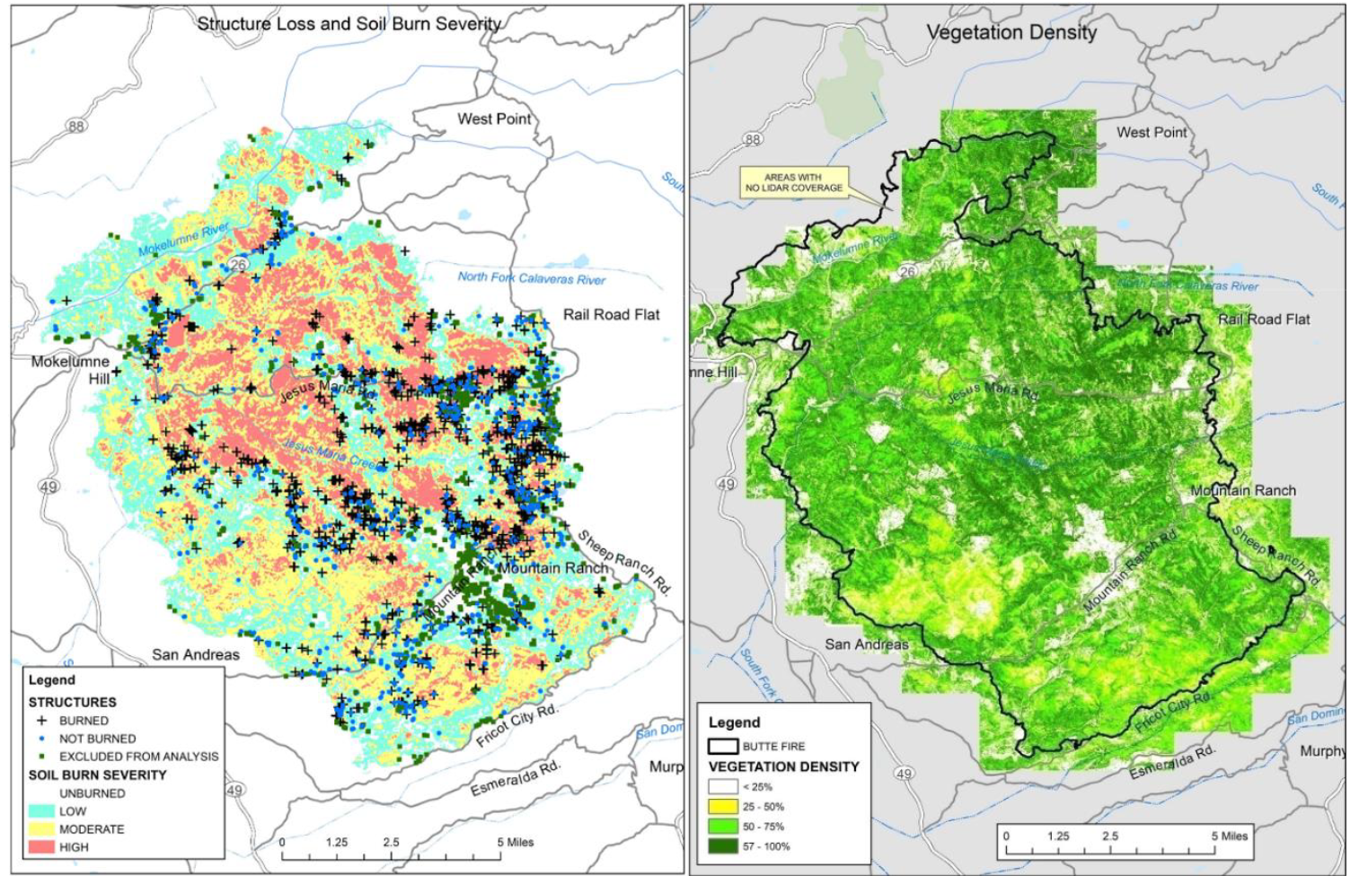
- Schmidt J (2020). The butte fire: A case study in using LiDAR measures of pre-fire vegetation to estimate structure loss rates. MPRA Paper No. 99699, Munich Personal RePEc Archive, Munich, Germany. [Google Scholar]
- Schulze S, Fischer EC, and Mahmoud H (2021). Framework for post-wildfire investigation of buildings: Integrating LiDAR data and numerical modeling. Fire Technology, 57(5): 2407-2432. https://doi.org/10.1007/s10694-021-01124-y [Google Scholar]
- USGS (2021). 3DEP LidarExplorer. Available online at: https://prd-tnm.s3.amazonaws.com/LidarExplorer/index.html