
International
ADVANCED AND APPLIED SCIENCES
EISSN: 2313-3724, Print ISSN:2313-626X
Frequency: 12
![]()
Volume 6, Issue 5 (May 2019), Pages: 50-58

----------------------------------------------
Original Research Paper
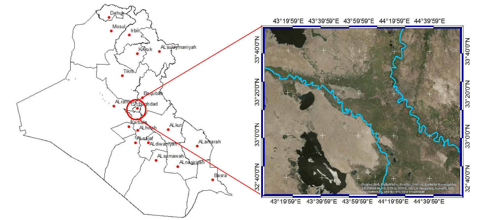
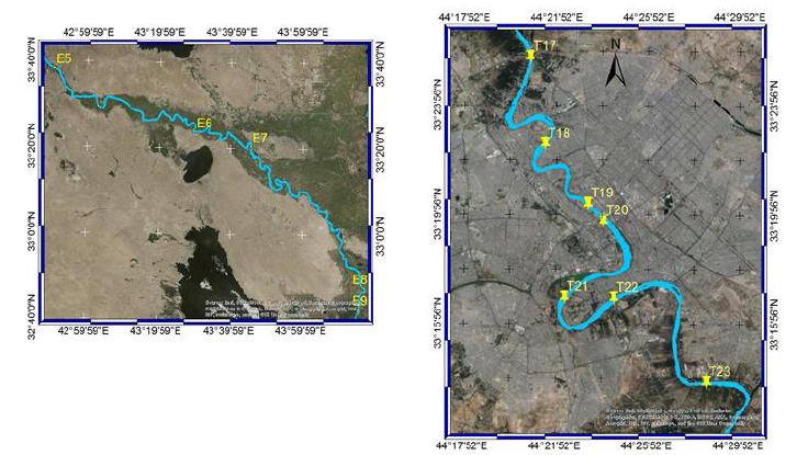
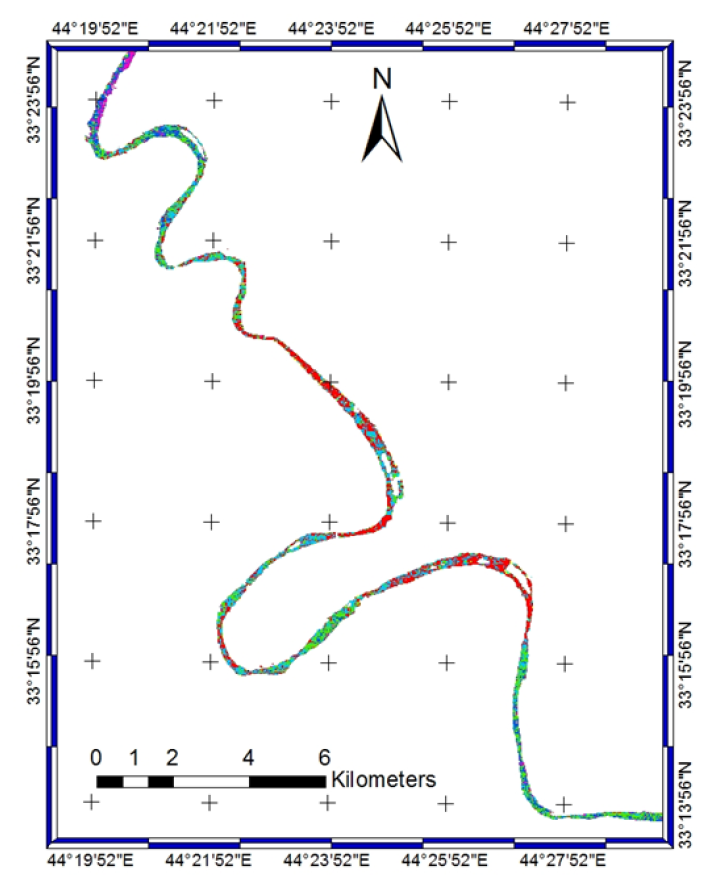
Title: Landsat data to estimate a model of water quality parameters in Tigris and Euphrates rivers – Iraq
Author(s): Malik R. Abbas 1, 2, *, Abd Wahid Bin Rasib 1, Baharin Bin Ahmad 1, Tajul Ariffin Bin Musa 1, Talib R. Abbas 3, Hafsat S. Dutsenwai 1
Affiliation(s):
1Department of Remote Sensing, Faculty of Built Environment and Surveying, Universiti Teknologi, Malaysia, UTM, 81310 Johor Bahru, Johor, Malaysia
2Space and Communication Directorate, Ministry of Science and Technology, Baghdad, Iraq
3Environment and Water Directorate, Ministry of Science and Technology, Baghdad, Iraq

* Corresponding Author.
 Corresponding author's ORCID profile: https://orcid.org/0000-0002-2166-0951
Digital Object Identifier:
https://doi.org/10.21833/ijaas.2019.05.009
Abstract:
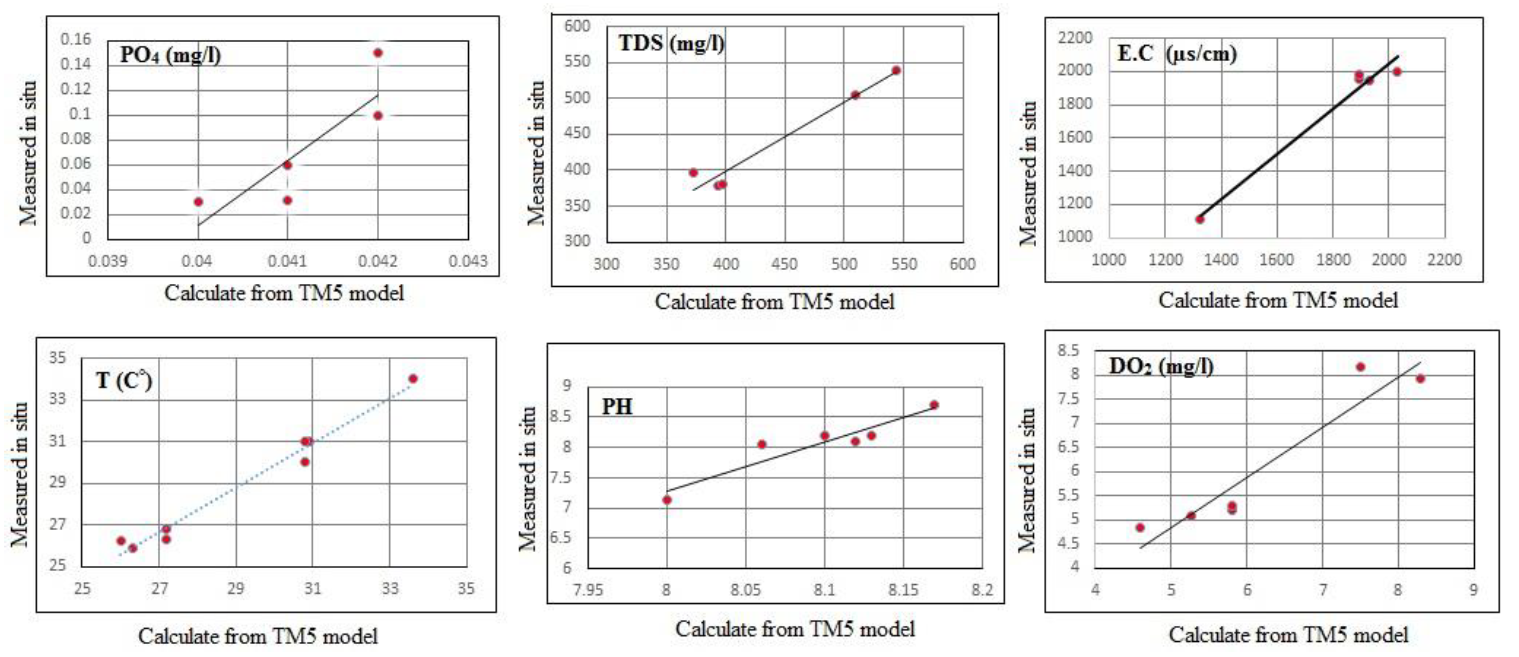
Tigris and Euphrates are the two main rivers that supply the water demanded by all the cities in Iraq. However, due to contentious deterioration, monitoring the water quality of these two rivers has become a necessity. Hence, there is need for a study concerning water quality modelling using satellite data for the rivers of Iraq. The main objective of this study is to create a new simple and accurate algorithm for the extraction of water quality parameters for the rivers of Iraq using Landsat 5 satellite data as a cheap and effective method for the monitoring of polluted rivers in Iraq. The area of study is located in the central region of Iraq. The water quality data archive was acquired in August 2007, and it represents the daily values for six physical and chemical water parameters: Dissolved Oxygen DO2, Total dissolved solids TDS, pH value, Orthophosphate PO4, Electrical conductivity E.C and Water temperature T. The parameter data were compared with the reflectance values of Landsat 5 bands using different band combinations of empirical algorithms. The results of the analysis showed a significant correlation between these models and water quality parameters with R2 > 0.83. The results of comparison between the predicted water quality parameters and those in the archive displayed more reliability for the models used, R2 = (0.73 – 0.97). The results of spatial analysis demonstrated the possibility of using the Landsat’s spectrum bands for the evaluation of the water quality for rivers in Iraq.
© 2019 The Authors. Published by IASE.
This is an
Keywords: Landsat, Tigris, Water quality, Iraq rivers, TDS
Article History: Received 28 November 2018, Received in revised form 11 March 2019, Accepted 15 March 2019
Acknowledgement:
The authors would like to express their profound gratitude to Faculty of Built Environment and Surveying (FABU), Universiti Teknologi Malaysia (UTM) for all the support that been provided. The authors also would like to thank UTM for providing the financial support through FRGS VOT 4F336 and GUP-Tier 1 grant VOT 20H01.
Compliance with ethical standards
Conflict of interest: The authors declare that they have no conflict of interest.
Citation:
Abbas MR, Rasib AWB, and Ahmad BB et al. (2019). Landsat data to estimate a model of water quality parameters in Tigris and Euphrates rivers – Iraq. International Journal of Advanced and Applied Sciences, 6(5): 50-58
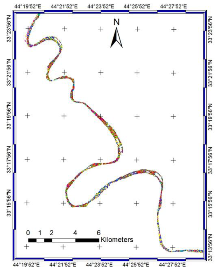
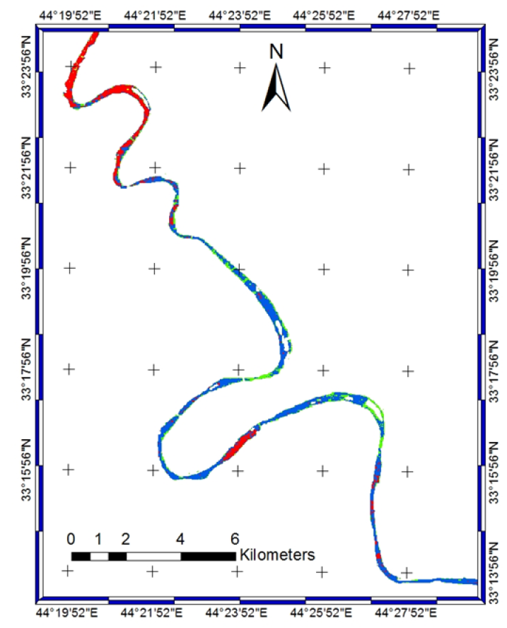
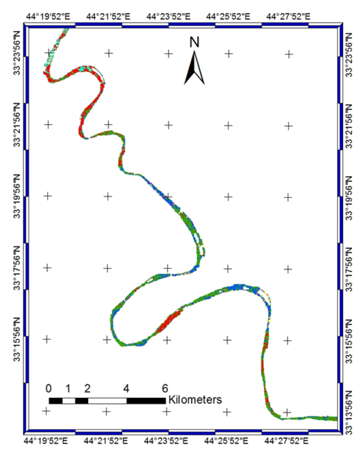
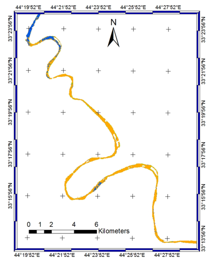
Figures
Fig. 1 Fig. 2 Fig. 3 Fig. 4 Fig. 5 Fig. 6 Fig. 7 Fig. 8 Fig. 9
Tables
----------------------------------------------
References (44)
- Abbas MR, Ahmad BB, and Abbas TR (2015). Use MODIS satellite data to study new phenomena of underground fire in the Al Ruhban oasis in Al Najaf city, Iraq. Environmental Earth Sciences, 73(7): 3475-3485. https://doi.org/10.1007/s12665-014-3632-8 [Google Scholar]
- Alexakis D (2008). Geochemistry of stream sediments as a tool for assessing contamination by Arsenic, Chromium and other toxic elements: East Attica region, Greece. European Water, 21(22): 57-72. [Google Scholar]
- Al-Khateeb M, Al-Ansari N, and Knutsson S (2016). A spatial sustainable development model based on partnership between government, community and specialist in Baghdad. Creative Education, 7(14): 1881-1890. https://doi.org/10.4236/ce.2016.714190 [Google Scholar]
- Alparslan E, Aydöner C, Tufekci V, and Tüfekci H (2007). Water quality assessment at Ömerli dam using remote sensing techniques. Environmental Monitoring and Assessment, 135(1-3): 391-398. https://doi.org/10.1007/s10661-007-9658-6 [Google Scholar] PMid:17345006
- Ammenberg P, Flink P, Lindell T, Pierson D, and Strombeck N (2002). Bio-optical modelling combined with remote sensing to assess water quality. International Journal of Remote Sensing, 23(8): 1621-1638. https://doi.org/10.1080/01431160110071860 [Google Scholar]
- Anand J, Gosain AK, Khosa R, and Srinivasan R (2018). Regional scale hydrologic modeling for prediction of water balance, analysis of trends in streamflow and variations in streamflow: The case study of the Ganga river basin. Journal of Hydrology: Regional Studies, 16: 32-53. [Google Scholar]
- Azab AM (2012). Integrating GIS, remote sensing and mathematical modelling for surface water quality management in irrigated watersheds. Ph.D. Dissertation, IHE Delft Institute for Water Education, Delft, Netherlands. https://doi.org/10.1201/b11797 [Google Scholar]
- Bouchahma M and Yan W (2012). Automatic measurement of shoreline change on Djerba Island of Tunisia. Computer and Information Science, 5(5): 17-24. https://doi.org/10.5539/cis.v5n5p17 [Google Scholar]
- Chander G, Markham BL, and Helder DL (2009). Summary of current radiometric calibration coefficients for Landsat MSS, TM, ETM+, and EO-1 ALI sensors. Remote Sensing of Environment, 113(5): 893-903. https://doi.org/10.1016/j.rse.2009.01.007 [Google Scholar]
- Cooper DI and Asrar G (1989). Evaluating atmospheric correction models for retrieving surface temperatures from the AVHRR over a tallgrass prairie. Remote Sensing of Environment, 27(1): 93-102. https://doi.org/10.1016/0034-4257(89)90040-0 [Google Scholar]
- Duan H, Zhang Y, Zhang B, Song K, and Wang Z (2007). Assessment of chlorophyll-a concentration and trophic state for Lake Chagan using Landsat TM and field spectral data. Environmental Monitoring and Assessment, 129(1-3): 295-308. https://doi.org/10.1007/s10661-006-9362-y [Google Scholar] PMid:17057973
- Eaton AD, Clesceri LS, Greenberg AE, and Franson MAH (2005). Standard methods for the examination of water and wastewater. American Public Health Association, Washington, D.C., USA. [Google Scholar]
- Gamvroula D, Alexakis D, and Stamatis G (2013). Diagnosis of groundwater quality and assessment of contamination sources in the Megara basin (Attica, Greece). Arabian Journal of Geosciences, 6(7): 2367-2381. https://doi.org/10.1007/s12517-012-0533-6 [Google Scholar]
- González-Márquez LC, Torres-Bejarano FM, Torregroza-Espinosa AC, Hansen-Rodríguez IR, and Rodríguez-Gallegos HB (2018). Use of LANDSAT 8 images for depth and water quality assessment of El Guájaro reservoir, Colombia. Journal of South American Earth Sciences, 82: 231-238. https://doi.org/10.1016/j.jsames.2018.01.004 [Google Scholar]
- Hellweger FL, Schlosser P, Lall U, and Weissel JK (2004). Use of satellite imagery for water quality studies in New York Harbor. Estuarine, Coastal and Shelf Science, 61(3): 437-448. https://doi.org/10.1016/j.ecss.2004.06.019 [Google Scholar]
- Hergenrader GL (1976). Application of remote sensing in the determination of water quality in Nebraska reservoirs. Technical Report NASA-CR-148776, NASA, USA. [Google Scholar]
- Irish RR (2000). Landsat 7 science data users handbook. National Aeronautics and Space Administration, Washington, D.C., USA. [Google Scholar]
- Ismail AH and Abed GA (2013). BOD and DO modeling for Tigris River at Baghdad city portion using QUAL2K model. Journal of Kerbala University, 11(3): 257-273. [Google Scholar]
- Ji L, Zhang L, and Wylie B (2009). Analysis of dynamic thresholds for the normalized difference water index. Photogrammetric Engineering and Remote Sensing, 75(11): 1307-1317. https://doi.org/10.14358/PERS.75.11.1307 [Google Scholar]
- Jones JS (2010). Detecting decadal forest canopy change during a native insect outbreak in the Ozark national forest, Arkansas. M.Sc. Thesis, University of Arkansas, Fayetteville, AR, USA. [Google Scholar]
- Kadhem AJ (2013). Assessment of water quality in Tigris River-Iraq by using GIS mapping. Natural Resources, 4(6): 441-448. https://doi.org/10.4236/nr.2013.46054 [Google Scholar]
- Khorram S (1981). Use of ocean color scanner data in water quality mapping. Photogrammetric Engineering and Remote Sensing, 47: 667-676. [Google Scholar]
- Kirk JT (1994). Light and photosynthesis in aquatic ecosystems. Cambridge University Press, Cambridge, UK. https://doi.org/10.1017/CBO9780511623370 [Google Scholar]
- Klemas V, Borchardt JF, and Treasure WM (1971). Suspended sediment observations from ERTS-1. Remote Sensing of Environment, 2: 205-221. https://doi.org/10.1016/0034-4257(71)90094-0 [Google Scholar]
- Kloiber SM, Brezonik PL, Olmanson LG, and Bauer ME (2002). A procedure for regional lake water clarity assessment using Landsat multispectral data. Remote Sensing of Environment, 82(1): 38-47. https://doi.org/10.1016/S0034-4257(02)00022-6 [Google Scholar]
- Koponen S, Pulliainen J, Kallio K, and Hallikainen M (2002). Lake water quality classification with airborne hyperspectral spectrometer and simulated MERIS data. Remote Sensing of Environment, 79(1): 51-59. https://doi.org/10.1016/S0034-4257(01)00238-3 [Google Scholar]
- Kritikos H, Yorinks L, and Smith H (1974). Suspended solids analysis using ERTS-A data. Remote Sensing of Environment, 3(1): 69-78. https://doi.org/10.1016/0034-4257(74)90039-X [Google Scholar]
- Lagios E, Vassilopoulou S, Sakkas V, Dietrich V, Damiata BN, and Ganas A (2007). Testing satellite and ground thermal imaging of low-temperature fumarolic fields: The dormant Nisyros Volcano (Greece). ISPRS Journal of Photogrammetry and Remote Sensing, 62(6): 447-460. https://doi.org/10.1016/j.isprsjprs.2007.07.003 [Google Scholar]
- Lamaro AA, Marinelarena A, Torrusio SE, and Sala SE (2013). Water surface temperature estimation from Landsat 7 ETM+ thermal infrared data using the generalized single-channel method: Case study of Embalse del Río Tercero (Córdoba, Argentina). Advances in Space Research, 51(3): 492-500. https://doi.org/10.1016/j.asr.2012.09.032 [Google Scholar]
- Liang S, Fang H, and Chen M (2001). Atmospheric correction of Landsat ETM+ land surface imagery. I. Methods. IEEE Transactions on Geoscience and Remote Sensing, 39(11): 2490-2498. https://doi.org/10.1109/36.964986 [Google Scholar]
- Liu H and Jezek KC (2004). Automated extraction of coastline from satellite imagery by integrating Canny edge detection and locally adaptive thresholding methods. International Journal of Remote Sensing, 25(5): 937-958. https://doi.org/10.1080/0143116031000139890 [Google Scholar]
- McFeeters SK (1996). The use of the normalized difference water index (NDWI) in the delineation of open water features. International Journal of Remote Sensing, 17(7): 1425-1432. https://doi.org/10.1080/01431169608948714 [Google Scholar]
- Moran MS, Bryant R, Thome K, Ni W, Nouvellon Y, Gonzalez-Dugo MP, and Clarke TR (2001). A refined empirical line approach for reflectance factor retrieval from Landsat-5 TM and Landsat-7 ETM+. Remote Sensing of Environment, 78(1-2): 71-82. https://doi.org/10.1016/S0034-4257(01)00250-4 [Google Scholar]
- Murray NJ, Phinn SR, Clemens RS, Roelfsema CM, and Fuller RA (2012). Continental scale mapping of tidal flats across East Asia using the Landsat archive. Remote Sensing, 4(11): 3417-3426. https://doi.org/10.3390/rs4113417 [Google Scholar]
- Nas B, Karabork H, Ekercin S, and Berktay A (2009). Mapping chlorophyll-a through in-situ measurements and Terra ASTER satellite data. Environmental Monitoring and Assessment, 157(1-4): 375-382. https://doi.org/10.1007/s10661-008-0542-9 [Google Scholar] PMid:18821023
- Qin Q, Zhang N, Nan P, and Chai L (2011). Geothermal area detection using Landsat ETM+ thermal infrared data and its mechanistic analysis—A case study in Tengchong, China. International Journal of Applied Earth Observation and Geoinformation, 13(4): 552-559. https://doi.org/10.1016/j.jag.2011.02.005 [Google Scholar]
- Rogan J and Chen D (2004). Remote sensing technology for mapping and monitoring land-cover and land-use change. Progress in Planning, 61(4): 301-325. https://doi.org/10.1016/S0305-9006(03)00066-7 [Google Scholar]
- San ABT and Suzen ML (2010). Evaluation of different atmospheric correction algorithms for EO-1 Hyperion imagery. International Archives of the Photogrammetry, Remote Sensing and Spatial Information Science, 38(Part 8): 392-397. [Google Scholar]
- Sharma B, Kumar M, Denis DM, and Singh SK (2018). Appraisal of river water quality using open-access earth observation data set: A study of river Ganga at Allahabad (India). Sustainable Water Resources Management, Springer International Publishing, New York, USA: 1-11. [Google Scholar]
- Tyagi P and Bhosle U (2011). Atmospheric correction of remotely sensed images in spatial and transform domain. International Journal of Image Processing, 5(5): 564-579. [Google Scholar]
- Tyler AN, Svab E, Preston T, Présing M, and Kovács WA (2006). Remote sensing of the water quality of shallow lakes: A mixture modelling approach to quantifying phytoplankton in water characterized by high‐suspended sediment. International Journal of Remote Sensing, 27(8): 1521-1537. https://doi.org/10.1080/01431160500419311 [Google Scholar]
- Wukelic GE, Gibbons DE, Martucci LM, and Foote HP (1989). Radiometric calibration of Landsat Thematic Mapper thermal band. Remote Sensing of Environment, 28: 339-347. https://doi.org/10.1016/0034-4257(89)90125-9 [Google Scholar]
- Yüzügüllü O and Aksoy A (2011). Determination of Secchi disc depths in lake Eymir using remotely sensed data. Procedia-Social and Behavioral Sciences, 19: 586-592. https://doi.org/10.1016/j.sbspro.2011.05.173 [Google Scholar]
- Zhang Y, Pulliainen J, Koponen S, and Hallikainen M (2003). Empirical algorithms for Secchi disk depth using optical and microwave remote sensing data from the Gulf of Finland and the Archipelago Sea. Boreal Environment Research, 8(3): 251-261. [Google Scholar]